Esri UK has provided a local names basemap for over 5 years which features Welsh and Scottish Gaelic names where they are available. Initially this began with just a few layers, but we have expanded it to include all layers.
What’s Changing?
We’ve changed the text-field property from _name to _name_local. This change ensures that all labels across Great Britain appear in their local language, where available.
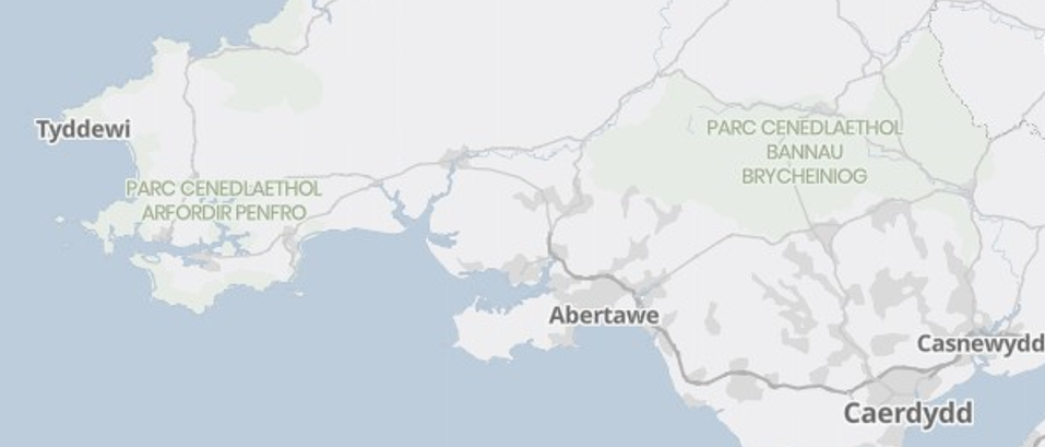
One notable impact is in Wales, where national park names now appear in Welsh. For example:
- Snowdonia National Park will appear as Eryri National Park in the English basemap and Parc Cenedlaethol Eryri in the Local names basemap
- Brecon Beacons National Park will appear as Bannau Brycheiniog National Park in the English basemap and Parc Cenedlaethol Bannau Brycheiniog in the Local names basemap
Will This Affect You?
If you’re using one of the local names basemaps as-is, you’ll see the updated labels automatically.
However, if you’ve applied custom styling to this service (e.g. through the Vector Tile Style Editor or JSON edits), this change may affect how labels appear in your maps or apps.
What You Should Do
- Review any custom styles you’ve applied to the basemap.
- Test your maps to ensure labels appear as expected.
- Update your styles if needed to reference the new _name_local field.
If you have any questions or need support, please don’t hesitate to get in touch with us.