Machine Learning in GIS is not new – machine learning capabilities were introduced in ArcGIS as early as 2009. Recognise this?
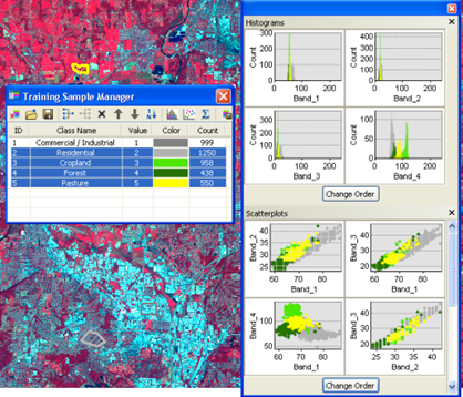
You’ve been able to use machine learning in ArcGIS to perform image classification, enrich data with clustering, or model spatial relationships for decades (yes, even in ArcMap).
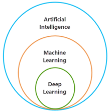
Machine learning has evolved substantially since then, like all forms of AI, particularly with the advent of deep learning – a subset of machine learning that uses several layers of algorithms in the form of neural networks. The intersection of AI and spatial analysis, often referred to as GeoAI, has been increasingly shaped by deep learning.
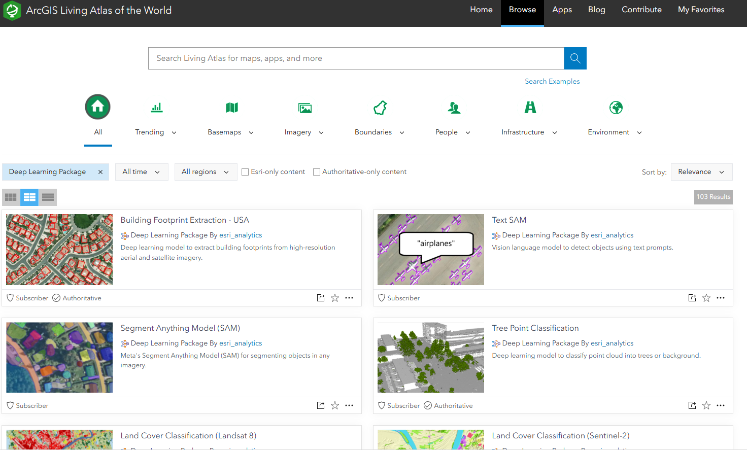
On October 7, 2020, the first deep learning pre-trained AI model was publicly released within the ArcGIS Living Atlas of the World, a repository now containing more than 100 pre-trained models.
Back in 2021, we explored how Esri’s pre-trained deep learning models made machine learning accessible in this blog – even for those of us with zero coding experience. Fast forward to today, and it’s fair to say things are still evolving. Not only have the tools become more powerful and accurate, but they’ve also become even more accessible, scalable, and integrated across the ArcGIS system.
Let’s dive into what’s new, what’s improved, and how you can get hands-on with the latest generation of machine learning in ArcGIS – with a focus on no code options.
What’s New in Pre-trained Models?
The library of pre-trained models available in the ArcGIS Living Atlas has grown a lot since our last blog – and so has their versatility. No matter what sector you work in, there’s probably a model ready to go. Some of the most popular new arrivals include:
⛅ Weather and climate forecasting – a deep learning model to forecast weather and climate related phenomenon using MERRA-2 multidimensional dataset.
📝 Text SAM – a vision language model to detect objects in imagery using text prompts.
🌳 Tree Segmentation – used to detect and segment trees in high-resolution imagery.
📷 Vision Language Context-Based Classification – a deep learning package to classify objects form natural language using vision language models from OpenAI and Meta.
You can even detect my favourite animal from aerial imagery with Elephant Detection 🐘.
Each model is provided as a ready-to-use deep learning package, complete with metadata and guidance. And the best bit? A lot of these models run not just in ArcGIS Pro, but now also run directly in ArcGIS Online, where no local infrastructure is needed.
Just like before, you don’t need to train your own model or even write code – simply load them into one of the model inferencing options in ArcGIS Pro or ArcGIS Online. That said, training your own deep learning model without code has also become even easier, with the introduction of the “Train Deep Learning Model wizard” into ArcGIS Pro 3.2 onwards.
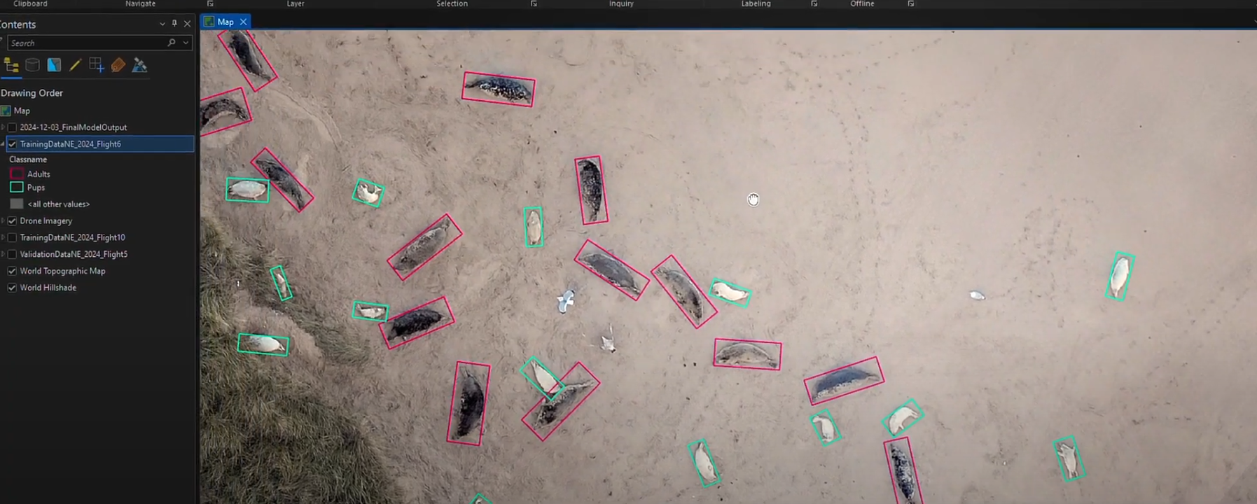
At this year’s Annual Conference we saw how Natural England are making use of Esri’s deep learning capabilities in ArcGIS Pro to train a deep learning model to count seals. This model was used to count over 8500 seals with 25% more accuracy than manual methods – all with no coding.
No GPU ? No problem
Using machine learning, you can extract features in imagery to understand patterns, such as detecting objects, classifying pixels, or detecting change. It allows us to automate an otherwise tedious task at scale. This process requires powerful computational resources, so one of the biggest barriers to entry used to be hardware requirements.
Back in our original blog, we’d called out the brand new at the time “ArcGIS Image for ArcGIS Online” extension. It brought our GeoAI capabilities to a SaaS environment, enabling cloud processing in ArcGIS Online. This allowed you to run deep learning models on hosted imagery layers to perform; pixel classification, object detection, or instance segmentation – without the need for powerful local hardware or extensive IT support. Fast forward to today and the same suite of capabilities have been fully integrated into ArcGIS Online. They are now available to anyone with a Professional or Professional Plus user type.
Integrating external AI service providers
One of the most exciting developments is the expanding options for integrating external cloud AI models into ArcGIS, like models from Hugging Face and OpenAI.
The Living Atlas now includes a whole host of new deep learning packages that bridge pre-trained open source models from the Hugging Face Hub with ArcGIS. These are primarily focused on Natural Language Processing (NLP) and Computer Vision (CV) applications – great for classifying imagery and answering questions.
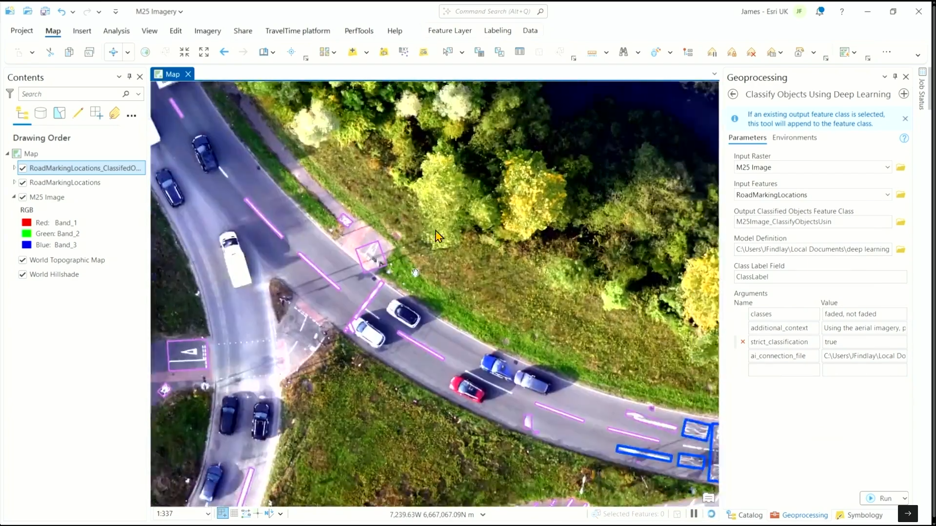
In ArcGIS Pro 3.5, a new Data Management tool was introduced called “Create AI Service Connection File” which allows you to easily and securely connect to hosted AI services. This connection file enables exciting new deep learning models like the Vision Language Context-Based Classification model to connect to vision language models which can classify objects from natural language prompts.
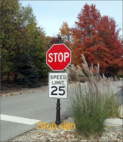
During the opening plenary of this year’s Annual Conference, we showed how this tool could be used to streamline the process of identifying and classifying faded road markings – making traditional workflows safer, more efficient, and accessible.
Trust
As the capabilities of GeoAI expand, so does the need for transparency, reliability, and ethical design. Esri’s Trusted AI framework ensures that the integration of AI into ArcGISis grounded in principles like security, fairness, and accountability. Whether you’re using deep learning models, AI assistants, or connecting to external models, trust is foundational.
ArcGIS products follow a “secure by design” approach, with privacy controls and administrative settings to let organisations decide when and how AI capabilities are used. Users remain in full control of their data – nothing is shared or used to train models without explicit consent. Behind the scenes, features like like transparency cards, red teaming, and human-in-the-loop safeguards help ensure outputs are helpful and responsibly generated.
GeoAI isn’t just about delivering results – it’s about doing so in a way that respects your data, your decisions, and your users. Read more about our trusted AI approach over at the ArcGIS Trust Center.
Final Thoughts
The AI landscape is changing fast, but ArcGIS is evolving right alongside. Whether you’re enhancing imagery analysis with one of the readily available deep learning packages, or training your own deep learning models, GeoAI in ArcGIS is more accessible than ever. What’s key is that you don’t need to be an expert in machine learning to benefit from these tools.
Take a look at the growing collection of deep learning models on the Living Atlas, and explore the GeoAI documentation to get started.
Easy peasy, again.