Tag Archives: ArcGIS Online

Creating Web Apps with Design in Mind
Beautiful cartography, effective labels, elegant styles – a lot of time and effort goes into creating maps. But we shouldn’t stop at the maps we create. A well thought through app design isn’t just about making something ‘pretty’, it’s about … Continue reading
Continue Reading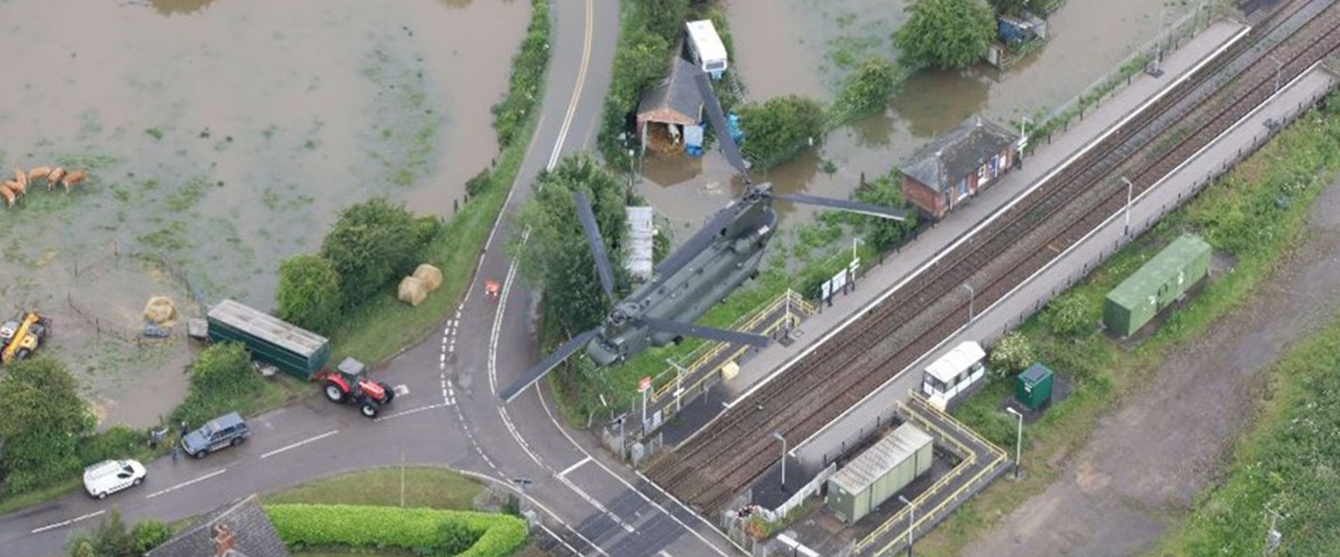
Lincolnshire Resilience Forum
30+ partnership organisations can now not only respond faster during emergencies but also collaborate effectively in proactive disaster planning and recovery initiatives.
Continue Reading
London Borough of Hounslow
Using InstantAtlas we have matured our approach to data management. We now have a collection of data sets and can deliver insights to target our services more effectively and provide our communities with the support they need.
Continue Reading
Cotswolds National Landscape and Triage
We have used ArcGIS Pro, ArcGIS Online, ArcGIS Dashboards and ArcGIS StoryMaps to create a next generation story-telling tool that will inform landscape, community and conservation strategies for generations to come.
Continue Reading
Chance to Shine
A simple ArcGIS web app is helping us to make cricket more accessible to young people from deprived communities and ethnic minority groups.
Continue Reading
What is GIS? Five key concepts to improve your understanding
When you’re running late for work and trying to find shortcuts along your route, you’re using GIS. When organisations have digitised plans of their estate, also GIS. Biologists tracking animal migrations… You can guess where I’m going with this. So, … Continue reading
Continue Reading
RUSI
We analyse complex, evolving military situations with ArcGIS Pro, providing actionable intelligence from open source geospatial data.
Continue Reading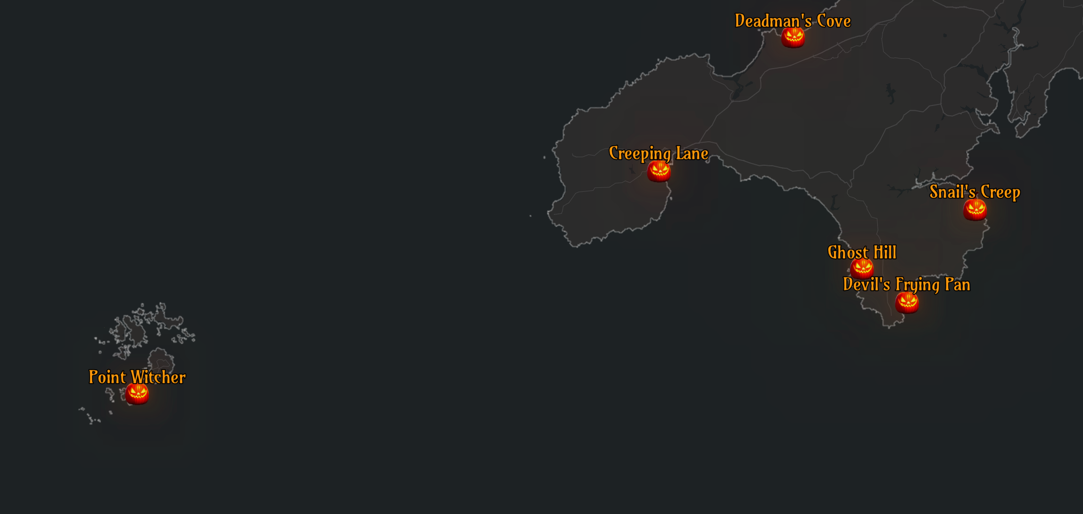
Creating a spooky map with the Living Atlas
Halloween is just around the corner, and what better way to celebrate than with a spooky map? Inspired by the Inferno map by John Nelson, we wanted to produce a scary map that centred on Halloween-related place names. In this … Continue reading
Continue Reading
Getting to grips with ArcGIS Connectors for Power Automate
ArcGIS Survey123 users have had the ability to enhance their workflows through automation for some time now, using connectors available in Power Automate and Make (formally Integromat). If you wanted to configure automated post-capture workflows for your other applications, there … Continue reading
Continue Reading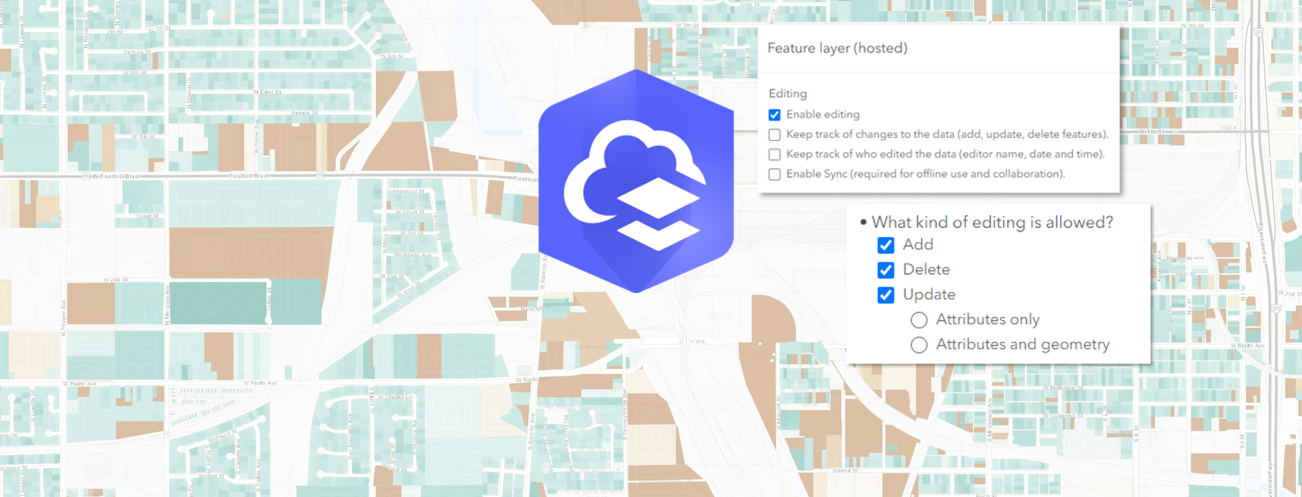
Web-editing in ArcGIS: learn to easily manage feature layer edits
Create polygons for building outlines. Update attributes for utility networks. Delete outdated bird spotting points from your wildlife watcher’s map (or feel free to insert your own oddly specific example to further progress this introduction). Whatever the case, editing in … Continue reading
Continue Reading