Tag Archives: ArcGIS Online

Getting to know My Esri: insights from Technical Support
Being organised makes things easier, regardless of what it is we’re talking about (though I’m hoping you know where I’m going with this considering the title). With administrative tasks, having everything in one place limits the time you spend searching … Continue reading
Continue Reading
NHS Fife
Managing our natural capital and meeting our sustainability responsibilities is so much easier with our ArcGIS Greenspaces Map.
Continue ReadingCustomising your ArcGIS experience with URL parameters
Did you know that many of the web and mobile applications in ArcGIS Online and ArcGIS Enterprise support the use of URL parameters to call your apps with additional instructions that define how you want them to appear to end … Continue reading
Continue ReadingGetting started with URL parameters in Survey123
Like many aspects of ArcGIS Online, web forms built using Survey123 can be accessed and modified in unique ways using URL parameters. In this blog, I’ll dive into how we can use them to help make submitting surveys a more … Continue reading
Continue Reading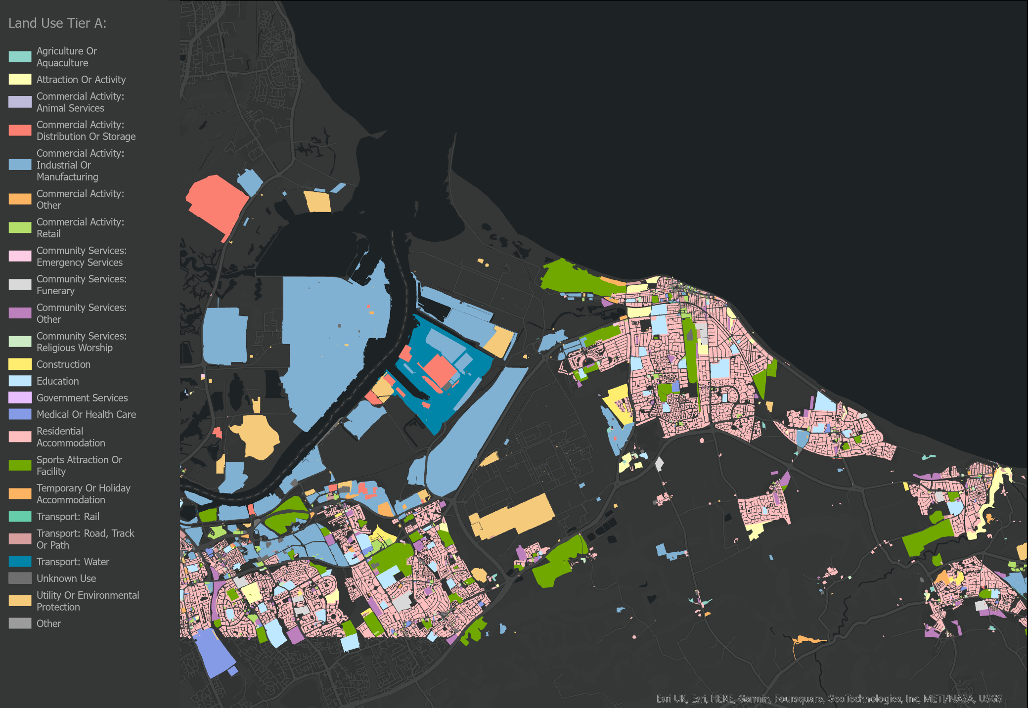
Cover more ground with the new Maps+ beta services
The new Maps+ Beta services are now live and available to existing Maps+ subscribers from within the ArcGIS Marketplace (sign in required). In anticipation of this, I took the opportunity to get to know the new arrivals to the Maps+ family. … Continue reading
Moving on from ArcGIS Map Viewer Classic
Both ArcGIS Online and ArcGIS Enterprise offer two map viewers for viewing, using and creating maps. The Map Viewer is a modern map-making tool that features fast and responsive mapping and real-time updates to the map as you work. Map … Continue reading
Continue ReadingCreate pop-ups that perform in ArcGIS Online
Mapping your data tells a visual story. But sometimes it feels like you’re only getting a chapter, or perhaps the first book of a semi-successful trilogy. Trying to present lots of data, or data with many relevant attributes, gets cluttered … Continue reading
Continue ReadingTurn data into dynamic reports with Report Builder for ArcGIS
Many of us using ArcGIS Online have got a huge amount of data stored in the cloud – hosted layers with a large number of features and fields that are simply overwhelming and difficult to get any useful information from. … Continue reading
Continue ReadingSmart Reporting made easy with Report Builder for ArcGIS
Report Builder for ArcGIS is a web-based application dedicated to designing and publishing virtually any type of report for data within ArcGIS Online. That could be your own ArcGIS data, your organisation’s data or even datasets readily available in the … Continue reading
Continue Reading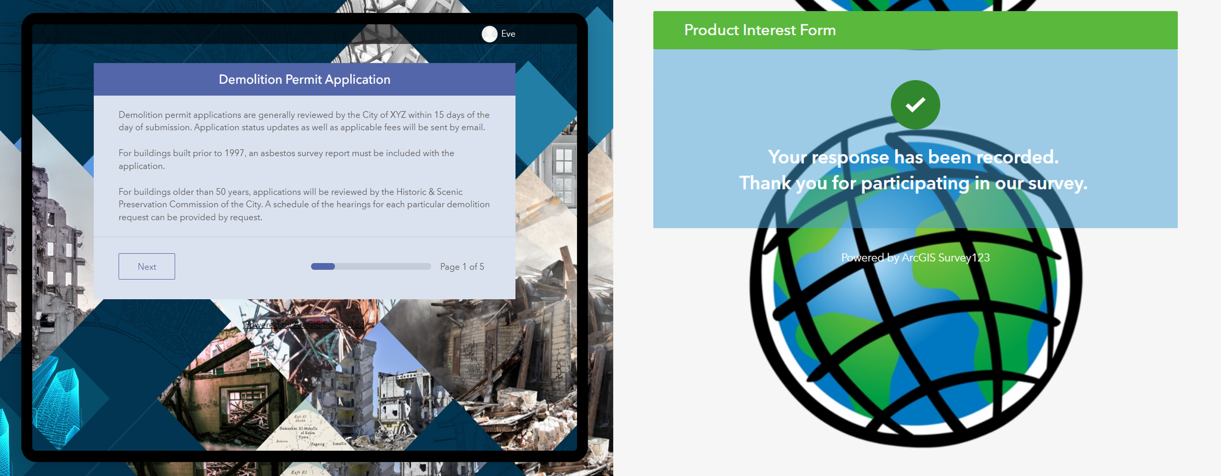
Designing surveys in Survey123: Ditch the default
Building surveys already requires planning to create something that’s easy to fill out for the end user. When you add in the need to brand the form to your organisation’s requirements or factor in efforts to structure it intuitively, it … Continue reading