Tag Archives: ArcGIS Pro
GIS for all: making an ArcGIS app for the classroom
After seeing John Nelson’s Storybook design, I really wanted to give it a try. I thought that this design would be great for educational resources, so I got in contact with our Education Team at Esri UK to see what … Continue reading
Continue Reading
Notes from a Notebooks Beginner
Starting to code can be scary and while there are some learning resources available, they sometimes seem aimed at developers. As a complete beginner, this was a little bit daunting for me. With this blog, I will show you how … Continue reading
Continue Reading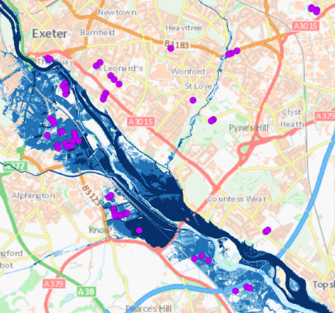
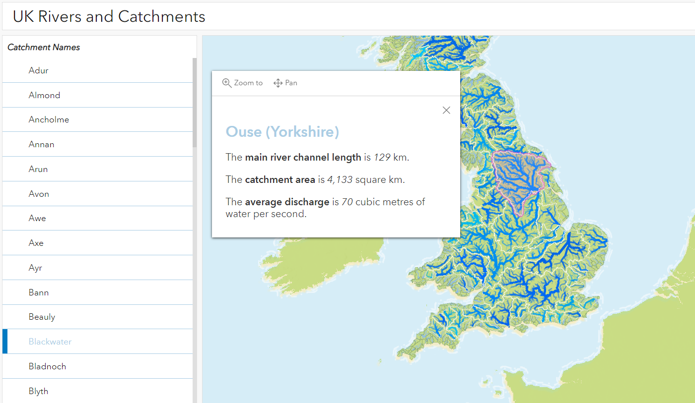
Analysing JBA Flood Maps in ArcGIS
Flooding poses an extreme threat to people’s livelihoods. Heavy rain and storm events cause surrounding rivers and coasts to become inundated with water, bringing a wealth of social, environmental and economic impacts. With floods of greater intensity predicted across much … Continue reading

NHS South, Central and West
ArcGIS has enabled us to build a complete, end-to-end process for allocating funding objectively to eligible community pharmacies.
Continue Reading
Addressing the benefits of ArcGIS Locators for finding places
Whether you are a locator aficionado or amateur, many of us are all too familiar with the satisfaction that comes from a seamless map-based search; be it by location, address or feature name. From my recent experience working with ArcGIS … Continue reading
Continue Reading
Jacobs
We are helping to shape public transport in Scotland for the next 20 years, by using ArcGIS to analyse, visualise and share data about the accessibility of current and proposed transport networks.
Continue Reading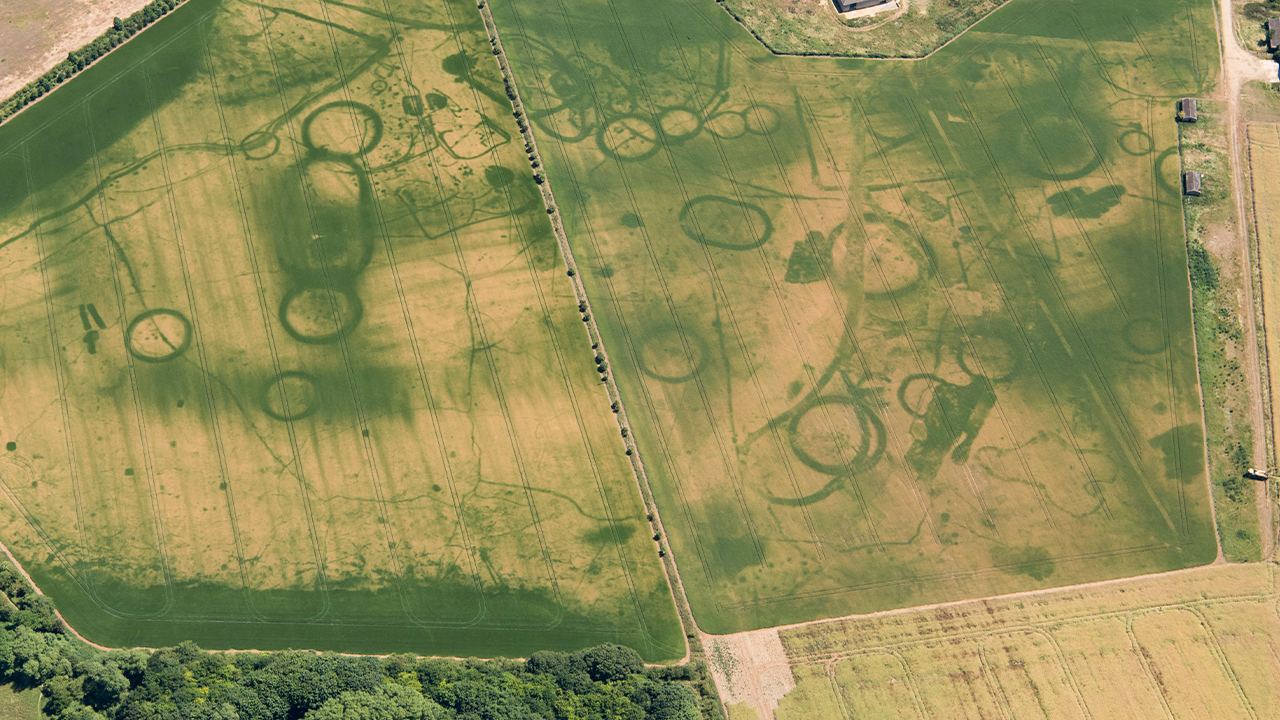
Historic England
We are helping people to discover and explore the rich archaeology of England by making our images and the mapping derived from them, accessible via ArcGIS
Continue ReadingLet your work flow with tasks in ArcGIS Pro
While I was creating my Electric Vehicle charge maps, I realised that I had developed a workflow in ArcGIS Pro that could be repeated for any highway in Britain. A colleague suggested that I try recording and sharing my workflow … Continue reading
Continue ReadingCartographic representations in ArcGIS Pro
Many of you will have made the switch from ArcMap to ArcGIS Pro already, but you may still need to move ArcMap content to the new ArcGIS Pro projects. So – what needs to happen if you want to start … Continue reading
Continue ReadingMapping 100 years of precipitation
In the UK, the 10 hottest years on record have all been since 2002 and in the summer of 2022, July and August were the warmest ever. Despite periods of rainfall, hosepipe bans were put in place across large areas … Continue reading
Continue Reading