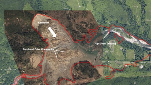
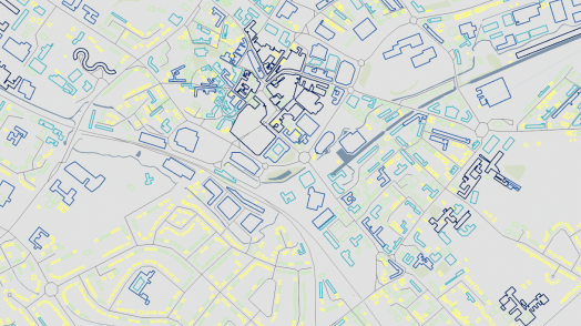
Blog Esri UK Tech Blog CategorySelect-- Select Category --3DCartographyContentData ManagementDeveloperMobileProduct NewsSpatial AnalysisTipsTechnologySelect-- Select Technology --AppsArcadeArcGIS EnterpriseArcGIS Experience BuilderArcGIS Living AtlasArcGIS OnlineArcGIS ProArcGIS StoryMapsDevelopersMobileReport Builder for ArcGISSweet for ArcGISUK ProductsUNE for ArcGISSearchSubmit Tips Designing Apps with Colour Blind Users in Mind 11th October 2018 Colour plays an integral role in UI design, but 1 in every 12 men and 1 in every 200 women (approximately) are colour blind.So, how do you design effective, accessible and aes... Read more Product News It’s time to get excited about the Aurora Project 28th September 2018 You may have heard about the Aurora Project through the Esri grapevine, but not been entirely sure what it is. In this blog, I’ll aim to demystify the Aurora Project, showing you how data collection will be improv... Read more Product News ArcGIS Online autumn harvest is gathered in 19th September 2018 The autumn update to ArcGIS Online brings a bounty of interesting new features. We’ve dug into a choice few. Read more Tips Some Awesome UI Freebies 7th September 2018 Our GIS community loves to share. We really do... So in the spirit of sharing here’s a list of UI Freebies. Read more Spatial Analysis Crime Analysis in ArcGIS Pro 31st August 2018 Back in June came the exciting news that Crime Analysis is available for ArcGIS Pro 2.2. But what exactly does this extension do and why is it useful to anyone - crime analyst or not? Read more Cartography Revealing hidden communities: a guide to multivariate dot density maps 9th August 2018 This is a multivariate dot density map. The map reveals religious identity across London. Each person is represented by a single dot - the colour depicting religious allegiance. So how did I create it? Read more Tips Pulling your brand into Esri Apps 27th July 2018 Esri apps have a default look and feel, but we often hear from users who want to re-style their apps to align with their organisations brand. **Spoiler alert** – you can, and it’s easy. Read more Content Accessing OS Open Zoomstack Vector Tiles in ArcGIS 20th July 2018 Building multiscale basemaps can be very challenging when you have to integrate different datasets into a consistent map base. OS have started an Open Zoomstack trial to explore ways to make this easier. One of ... Read more Content Inspiration to create your own Open Data site 17th July 2018 Many organisations use ArcGIS to share and work with Open Data. Creating an Open Data site using ArcGIS Hub is a great way to liberate your data so you can meet mandated transparency requirements and enable greate... Read more Cartography Visualising Lightning: an exercise in aggregating data 11th July 2018 I received some interesting data from the Met Office - lightning strike locations for the UK and Ireland. Given a new set of data there is a common process that I work through to arrive at the final map. Read more Tips Did you know: you can use custom HTML and CSS in Story Map Journal? 6th July 2018 The Story Map Journal template allows you to view and edit the HTML source for the narrative side panel. This gives you the ability to completely adjust how content in the side panel is presented. Read more Cartography Learn about: ArcGIS Maps for Adobe Creative Cloud 4th July 2018 The ArcGIS Maps for Adobe Creative Cloud is an app that allows you to work with data-driven maps in Adobe Illustrator and Photoshop. From these you can create beautiful, data-driven maps in hours, not days. Read more Pages: 1234567891011121314151617181920212223242526Load More